
9 Best Cheap GPS Units That Actually Work for Offroad Motorcycles
 Jake Miller
11 min read
Jake Miller
11 min read
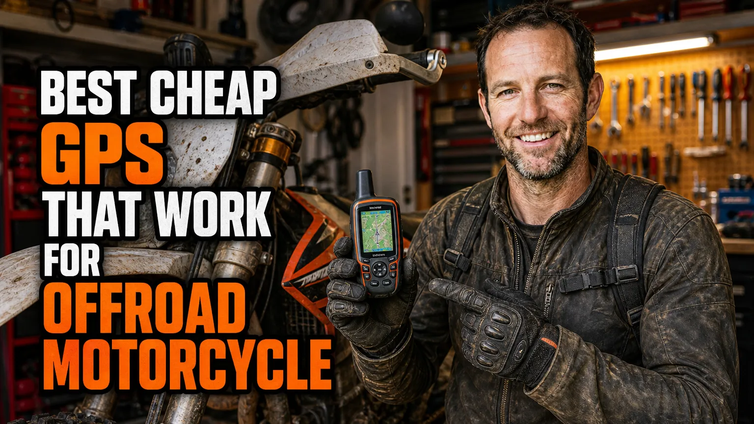
I have been riding dirt bikes for a long time, and for most of it my navigation plan was “follow whoever is in front of me.” That works right up until it does not. The first time I got separated from the group on a sixty-mile loop with no cell signal and no idea which fork in the trail led back to the truck, I decided I needed a real GPS. Then I looked at what dedicated adventure units cost and nearly fell off my bike.
So I spent the last few seasons testing cheap alternatives instead. Not cheap junk, but genuinely affordable units that survive dust, vibration, rain, and the occasional dirt nap. Some are dedicated handhelds, some are rugged phones running mapping apps, and one is a tiny Bluetooth receiver that turned an old tablet into a usable navigator.
Here is what actually worked for me, ranked roughly by how often I grab it before a ride.
- The Garmin eTrex 22x is the best all-round cheap GPS for dirt bikes at roughly $200.
- If you want to spend less, the eTrex 10 still logs tracks and gets you home for about $110.
- A rugged phone plus Gaia GPS or OsmAnd is the cheapest capable setup if you already own a phone.
- Button controls beat touchscreens when you are wearing muddy gloves.
- AA batteries are underrated: no charging cables, no dead units at camp.
1. Garmin eTrex 22x — The One I Reach For Most Often
If someone asked me to name one cheap GPS for offroad riding without hedging, this would be it. I have run the eTrex 22x on everything from rocky two-track to sloppy forest roads, and it has never once let me down in a way that mattered.
The screen is a 2.2-inch colour display that stays readable in direct sun, which is more than I can say for a phone at noon. It comes preloaded with TopoActive maps for your region, so you are not stuck with a useless basemap. There is also a microSD slot, which matters more than people realise once you start stacking map layers.
Battery life is rated around 25 hours on two AA batteries. I keep a spare pair of lithiums in my hydration pack and have never worried about power on a full day ride. It is rated IPX7, so a creek crossing or a rainstorm is not a problem.
The real reason I love it, though, is the buttons. Physical buttons mean I can zoom, pan, and drop a waypoint with gloves on and muddy hands. Every touchscreen I have used offroad eventually frustrates me. The eTrex 22x just works.
Garmin also sells a newer eTrex SE in the $150 range with Bluetooth phone pairing through the Garmin Explore app. If staying connected to your phone appeals to you, it is worth a look.
2. Garmin eTrex 10 — The Cheapest Way to Get Real GPS
When people ask me for the absolute cheapest option that is not a toy, I point them at the eTrex 10. It usually sells for around $100 to $120, and it does the one job that matters most when you are lost: it tells you where you are and how to get back to where you started.
The trade-off is the screen. The eTrex 10 has a 2.2-inch monochrome display and a worldwide basemap rather than detailed topo maps. You cannot load region-specific trail maps onto it. What you can do is record tracks, mark waypoints, and follow a breadcrumb trail back out.
Honestly, that is enough for a lot of riders. I used an eTrex 10 as a backup unit for two seasons, strapped to my bar pad, purely as a “find the truck” device. It runs 25 hours on two AA batteries, is IPX7 rated, and weighs almost nothing.
If your plan is to explore established trail systems and you mostly need a safety net, this is the least money you can spend on gear that genuinely works.
3. Garmin GPSMAP 65s — The Mid-Range Sweet Spot
Once you creep up to the $350 mark, the GPSMAP 65s becomes a serious proposition. I borrowed one for a week of high-country riding and had a hard time giving it back.
The headline feature for me is multi-band GNSS. It locks onto GPS, GLONASS, Galileo, and QZSS simultaneously. Under dense pine canopy, where my older units would let the track wander into the trees, the GPSMAP 65s held a clean line. That accuracy is worth real money on tight single track.
You get a 2.6-inch colour display, preloaded TopoActive maps, a 3-axis compass, a barometric altimeter, and a microSD slot. Battery life is around 16 hours on two AAs, which is shorter than the eTrex but still a full riding day.
It is bigger and heavier than the eTrex line, so mounting takes a bit more thought. But if you ride in thick timber or deep canyons, the extra satellite performance is not a luxury.
4. Garmin Foretrex 601 — Wear It Instead of Mounting It
Not everyone wants another brick bolted to their bars. The Foretrex 601 is a wrist-worn GPS that I strapped to my forearm for a season, and it solved a problem I did not know I had: nothing to break in a crash.
It has a small monochrome display, a 3-axis compass, a barometric altimeter, and support for both GPS and GLONASS. Battery life is outstanding at roughly 48 hours on two AAA batteries.
I used mine primarily for track logging and for the “point me back to the trailhead” arrow. The screen is too small for real map navigation, so do not buy it expecting to follow topo lines. But as a compact, nearly indestructible backup that lives on your wrist, it is excellent.
At around $200, the Foretrex 601 is also a great pairing with a phone running maps. The phone does the planning, the Foretrex does the recording and the safety arrow.
5. Garmin Montana 700 — The Big Screen Splurge
I know this is a “cheap GPS” list, but the Montana 700 deserves a mention because it is the cheapest way to get a genuinely large, glove-friendly screen. It runs around $500 to $550, which is not cheap, but it is a fraction of what dedicated adventure bike units cost.
The 5-inch colour touchscreen is the star. Garmin designed it to work with gloves, and in my testing that claim holds up better than most. You get preloaded TopoActive maps, a microSD slot, and a rechargeable battery pack rated for about 18 hours. It is IPX7 and built like a small cinder block.
If you ride with a group and want to hand the unit to a buddy to show them the route, the big screen is transformative. The Montana 700i adds inReach satellite messaging, but that jumps the price to around $700 and requires a subscription.
For me, the Montana 700 is the “buy once, cry once” pick on this list. It is the unit I would own if I only rode with a GPS and nothing else.
6. Trail Tech Voyager Pro — Built Specifically for Dirt Bikes
Most GPS units are designed for hikers or drivers. The Trail Tech Voyager Pro is designed for us. It is a 4-inch colour touchscreen that combines GPS navigation with a full instrument cluster.
In my experience, that combination is the real selling point. The Voyager Pro displays speed, engine temperature, and RPM alongside your map. Add the optional tyre pressure sensors and coolant temperature sensor and you have a complete bike dashboard with GPS baked in.
It runs about $400 to $450 depending on the kit and sensor bundle. Trail Tech also sells the simpler Voyager unit in the $280 range if you want the instrument cluster without the full navigation package.
Bluetooth lets it talk to your phone for track uploads. It is rugged, purpose-built, and mounts cleanly on most dirt bike triple clamps. If you want one device that does both navigation and bike telemetry, nothing else on this list comes close.
7. Beeline Moto II — Minimalist Navigation Done Well
The Beeline Moto II is the odd one out here, and I want to be honest about that. It is a small circular display, roughly $250 to $300, that shows a single arrow and a distance to your next turn. It pairs with your phone for routing.
For pure offroad route-following on tight single track, it is not the right tool. It does not show terrain, and it does not handle complex trail networks well. Where it shines is on dual-sport rides and connecting roads, where you just want a clean turn indicator without a big screen in your face.
It is IP67 rated, mounts to your bars with a solid aluminium clamp, and holds a charge for around 10 to 14 hours depending on how much the screen is lit. I used one on a mixed tarmac and gravel trip and genuinely enjoyed the minimalism.
Buy it if you want distraction-free guidance. Skip it if you need real topo navigation in the backcountry.
8. Kyocera DuraForce Pro 2 + Gaia GPS — Best Value Overall
Here is the setup I recommend to almost everyone who asks. Buy a used or refurbished Kyocera DuraForce Pro 2 for around $200 to $300, and run Gaia GPS or OsmAnd on it.
The DuraForce Pro 2 is IP68 rated and meets MIL-STD-810G for shock, vibration, and temperature extremes. It has a glove mode that increases touch sensitivity, which actually works. The 5-inch screen is bright enough for most daylight conditions.
The real advantage is flexibility. With Gaia GPS you get layered topo, satellite, and land boundary maps with offline downloads. OsmAnd gives you free offline vector maps with excellent trail detail. Both cost far less than dedicated GPS maps over the long run.
Alternatives worth considering include the Blackview BV7100 and the Ulefone Armor series, both of which pack enormous batteries for long days. I have used a Blackview as a dedicated navigation device and it ran for two full riding days on one charge.
9. Dual Electronics XGPS160 SkyPro — The Cheap Fix for an Old Phone or Tablet
Sometimes the problem is not the device, it is the GPS chip inside it. Older phones and most tablets have weak receivers that struggle under tree cover. That is where the Dual Electronics XGPS160 SkyPro comes in.
It is a small Bluetooth GPS receiver that pairs with up to five devices at once and updates at 10 times per second. The faster update rate means your position marker moves smoothly instead of jumping around, which matters a lot when you are trying to follow a trail at speed.
Battery life is roughly 10 hours, and it charges over micro-USB. I paid around $140 for mine and used it to turn an old Android tablet into a genuinely capable trail navigator mounted in a rugged case.
Garmin also makes the GLO 2, a similar Bluetooth receiver in the $100 range. Both work with Gaia GPS, OsmAnd, and most other mapping apps. If your phone already has a decent GPS chip, you can skip this entirely, but for tablets it is a game changer.
A Few Things I Learned the Hard Way
Whatever unit you pick, mount it with vibration isolation. Handlebars transmit a brutal amount of high-frequency vibration, and I have watched a cheap mount shear clean off mid-ride. A RAM Tough-Claw with a rubber isolation pad has never failed me.
Always tether your device with a lanyard. Screens crack, clamps loosen, and a GPS bouncing down a rock garden is a bad day.
Download your maps before you leave. Every single time I have forgotten, I have regretted it. Offline tiles for dedicated units and offline regions for phone apps are non-negotiable in the backcountry.
Finally, carry spare batteries. AA-powered units like the eTrex 22x and Foretrex 601 are worth their weight precisely because you can swap in fresh cells at camp instead of hunting for a USB outlet that does not exist.
None of these options will match a $900 adventure unit for screen size and map detail. But every one of them will get you home, and that is the only feature that actually matters when the sun starts dropping and you are still on the trail.
Frequently Asked Questions
Do I really need a dedicated GPS for offroad riding, or is my phone enough?
In my experience a phone works fine as a backup, but heat, vibration, and glove-unfriendly touchscreens make it frustrating as a primary unit. A cheap handheld like the Garmin eTrex 22x survives crashes and runs for days on AA batteries.
How do I mount a GPS on a dirt bike so it does not shake apart?
Use a vibration-damped mount such as a RAM Tough-Claw with a rubber isolation pad, and keep the unit tethered with a lanyard. Handlebars transmit far more high-frequency vibration than street bikes do, so isolation matters more than clamp strength.
Are budget GPS units accurate enough for tight single track?
Yes, if you pick a model with multi-band GNSS or at least GPS plus GLONASS. The Garmin GPSMAP 65s is the cheapest unit I have used that holds a line under dense tree cover without the track wandering.
What maps should I load before a backcountry ride?
I load Garmin TopoActive on dedicated units and Gaia GPS or OsmAnd on phones, then add local trail data and land boundary layers. Always download the region for offline use before you leave signal range.

Related Articles
6 Best Motorcycle Phone Mounts That Keep Your Phone Charged on the Road
Compare six dependable motorcycle phone mounts with wireless or USB charging, including fit, power wiring, vibration protection, weather resistance, and…
Jake Miller
10 min read
5 Best Motorcycle Phone Mounts for Naked Bikes and Open-Cockpit Riding
I compare secure, vibration-conscious phone mounts for naked and touring bikes, with fit notes, real trade-offs, and setup tips for…
Jake Miller
11 min read

7 Best Phone Mounts for Sport Bikes: Secure, Vibration-Smart Picks
Compare secure phone mounts for sport bikes, including clip-on fit, vibration control, case systems, prices, and my practical picks for…
Jake Miller
12 min read